


Terrasolid maps the world in 3D – 3D PluraView monitors visualize in Stereo
Impressively present intelligent point clouds and edit them precisely
For consistent and precise digital GIS and photogrammetry workflows, raw data must first be converted into integrable and thus valuable information components that meet the requirements of the respective application environments. The 3D point cloud processing modules from the Finnish software provider Terrasolid, such as TerraScan, TerraModeler, TerraMatch, TerraPhoto and TerraStereo, are highly developed, intelligent and powerful applications. They are able to process and model laser points with their XYZ coordinates at high speed and can also display the result in 3D-stereo. During the last 20 years, the capabilities of the available LiDAR hardware has developed rapidly together with the capabilities of the processing software, with Terrasolid applications at the forefront.
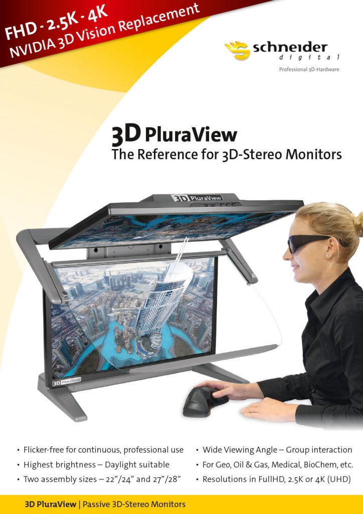
For the spatial viewing and measurement of 3D models, TerraStereo relies on the detailed, high-contrast 3D-stereo display of passive, double-screen beamsplitter systems, the 3D PluraView series from Schneider Digital. These high-end displays are the de-facto industry standard for all stereo-capable LiDAR, photogrammetry and GIS applications. The color representation of RGB-textured point clouds is truly amazing on the powerful and innovative 3D-stereo display systems from Schneider Digital. With a razor-sharp display in real time, they are completely flicker-free and can be used ‘plug & play’ for all TerraStereo functionality, such as precise 3-axis measurement in 3D space.
With screen diagonals up to 28“, the 3D PluraView monitors deliver highly detailed, stereoscopic 3D visualizations. Thanks to one monitor per eye, they offer up to 4K stereoscopic resolution and brilliant image brightness. Their optimal ergonomics and passive polarization filter technology ensures fatigue-free work even in normal daylight office conditions. Not only Terrasolid users appreciate the easy handling of the 3D PluraView monitors: 3D models can be easily displayed and easily measured or edited with a 3D mouse. Terrasolid users benefit from mature 3D visualization technology with the 3D PluraView monitors, established throughout the geospatial industry for many years.
Schneider Digital is the world’s leading manufacturer and distributor of customized hardware solutions for graphics-intensive computer applications and offers complete workplace solutions for the calculation and visualization of large data sets to professional users in the areas of GIS and photogrammetry. The powerful performance of Schneider Digital workstations, in combination with innovative high-end displays, have ensured fast and precise workflows in geospatial applications for over 25 years. Any 3D modeling workflow, no matter how complex, turns into an impressive presentation and a remarkable, high-resolution working model on a 3D PluraView monitor. Together with the high-end displays from Schneider Digital, professional users of the high-performance Terrasolid software suite get a complete package that is fine-tuned at the highest level. Measuring, capturing, analyzing and visualizing 3D data is not only convenient with these combined and innovative technologies, it also adds real to any demanding GIS workflow. For this reason, Schneider Digital has now officially certified TerraStereo for 3D-stereo visualization with its 3D PluraView monitors.
All other info about 3D stereo monitor 3D PluraView

Leica Geosystems & Schneider Digital: Reality capture becomes a productive 3D workflow

Review INTERGEO 2026: Geospatial meets 3D-Stereo and VR

LiDAR vs. Gaussian Splats – Stereo 3D with TerraStereo in a real-world comparison

MENA3D relies on Schneider Digital for the visualisation of complex geodata

QGIS in transition: open source GIS meets 3D and stereo

Review of the FIG 2026 Congress: Live 3D Stereo Visualization in Cape Town

Professional hardware solutions and components conveniently around order online around the clock!

For your direct individual product or solution request around professional hardware!

One click to personal advice - Live by our specialists via video, audio or chat!

Full-service solution provider for professional 4K/8K, 3D stereo and VR hardware: Customized solutions for demanding requirements and applications.


© by Schneider Digital | +49 8025 99300 [email protected]
