
Esri ArcGIS Pro compatible with Stealthmouse & Softmouse
New possibilities in 3D stereo mapping with leading GIS software
The compatible 3D input devices used for support in Esri ArcGIS Pro have now been expanded to include the Stealth mice with Z-protocol and the Softmouse 3D! In combination with the 3D PluraView stereo monitor, ArcGIS Pro users now have a wide range of extended functionalities and possibilities in stereo mapping at their disposal.
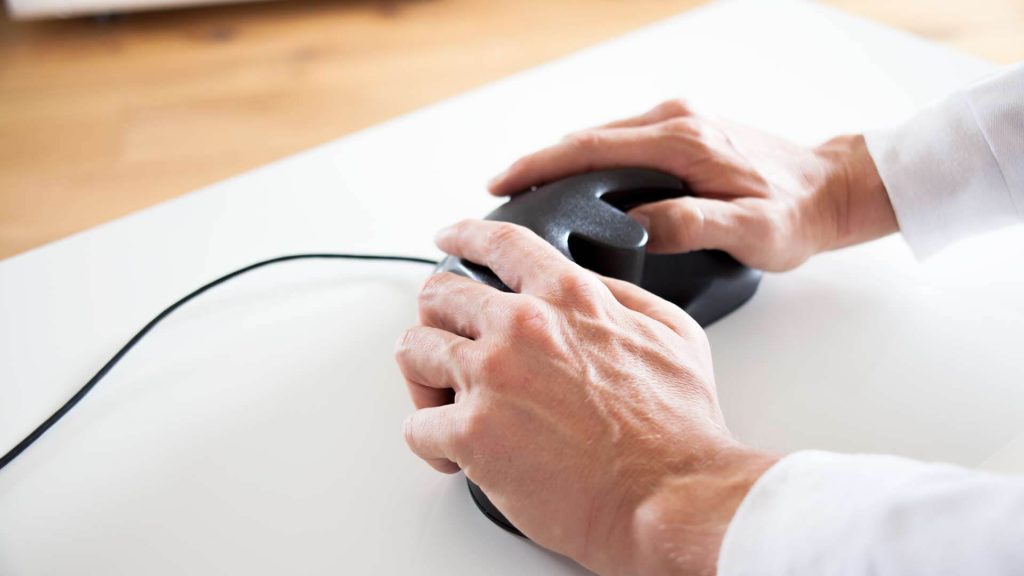
The Stealth mice with Z-protocol and the Softmouse 3D improve the workflow during stereoscopic mapping thanks to their ergonomics. They reduce digitising fatigue by supporting two-handed mouse operation and shorten feature compilation time by allowing fingertip access to multiple editing commands. Each device is equipped with a horizontal scroll wheel for precise elevation determination and multiple programmable buttons to enhance ease of use.
Esri’s ArcGIS Pro software fulfils all requirements for the efficient display and editing of GIS, BIM, LiDAR and photogrammetric geodata in a fully integrated 3D stereo working environment with an outstanding range of functions. The compatibility of ArcGIS Pro with the entire 3D PluraView Monitor product family has been officially certified by the manufacturer Schneider Digital.
Stereo Mapping – Stealth and Softmouse 3D support
The 3D input devices used to support stereo mapping in ArcGIS Pro have been expanded to include Stealth mice with Z-protocol and Softmouse 3D. These ergonomic devices improve the stereoscopic mapping workflow by reducing digitising fatigue by supporting two-handed mouse operation and reducing feature creation time. Access to multiple editing commands with fingertips is possible. Each 3D input device is equipped with a horizontal scroll wheel for precise height control and multiple programmable buttons to improve usability.
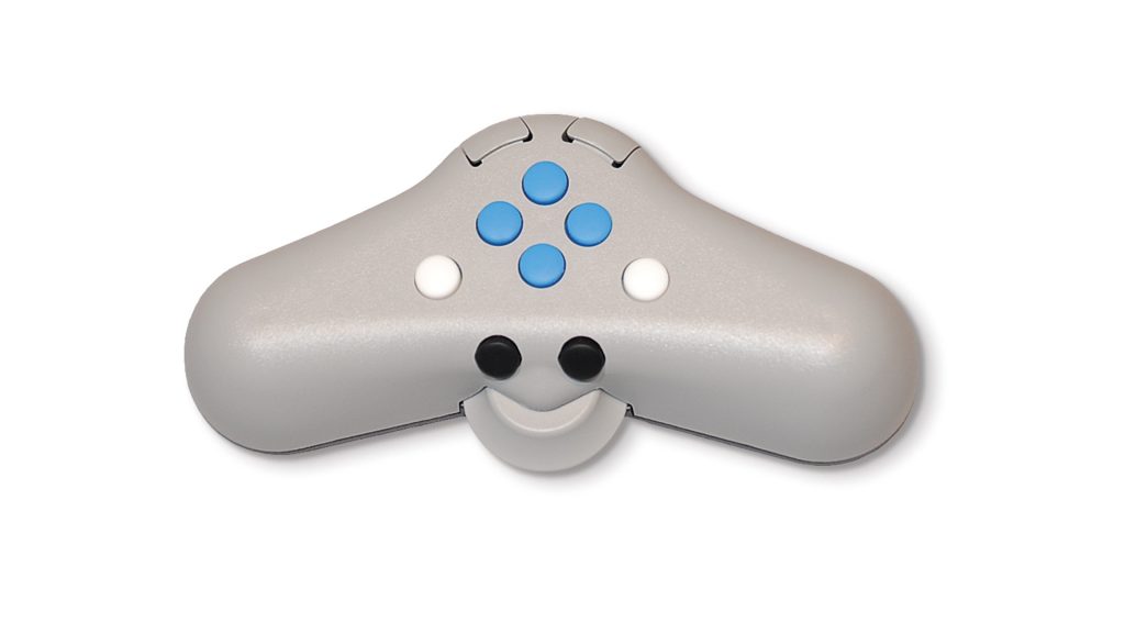
Stealth Mouse (S4 pictured, others similar)
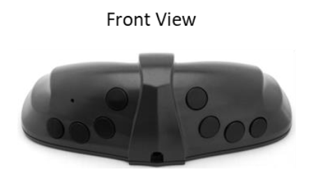
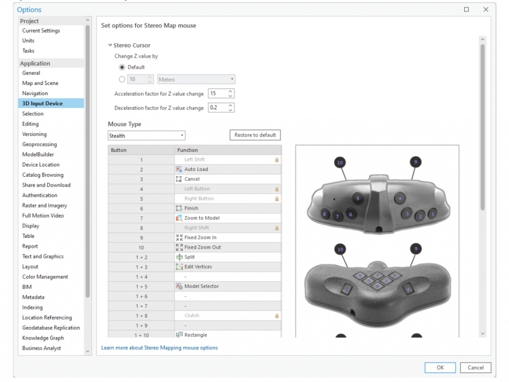
The Stealth mouse is an ergonomic 3D input device specifically designed for use in topographic mapping applications. All Stealth mouse models have 10 programmable buttons and a high-precision horizontal scroll wheel to support elevation definition. The S4 model also features two joysticks that support fine adjustment of position and elevation The ability to programme or map commands to mouse buttons enhances the stereoscopic editing process by performing frequently used editing functions directly at the user’s fingertips. It also minimises interruptions during feature creation by reducing the number of commands that need to be called from ArcGIS Pro.
In ArcGIS Pro, the Stealth mouse can be used both as a system mouse and as a stereoscopic input device.
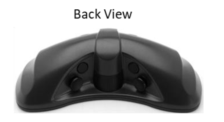
Softmouse 3D
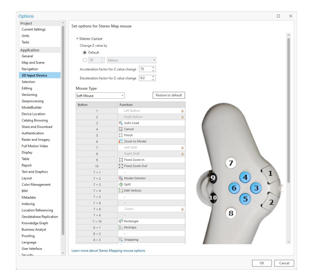
Softmouse 3D is an ergonomic 3D input device designed specifically for use in topographic mapping applications. The Softmouse device is equipped with 10 buttons and a high precision, horizontal thumbwheel to support accurate height definition. The 10 buttons can be programmed to store up to 20 commands which simplifies the editing workflow by enabling users to map commonly used editing commands to the Softmouse device. It also minimizes interruptions to the feature compilation process by lessening the need to access desired commands from ArcGIS Pro’s main menu.
In ArcGIS Pro, the Softmouse can be used as both a system mouse and a stereoscopic input device. Unlike your regular system mouse, the Softmouse mouse will not work outside the ArcGIS Pro environment.
Learn more about installing, setting up and using Stealth-Mouse and Softmouse 3D with Esri ArcGIS Pro:
Further information on Stealthmouse and Softmouse 3D:
Press release (July 2021):
Esri ArcGIS Pro certified for 3D stereo visualization with 3D PluraView monitors

By the way: If you want to learn more about our 3D stereo, VR/AR and 4K/8K solutions or professional hardware components (high-end monitors, professional graphics cards, high-end workstations, smart VR wall, peripheral solutions, etc.), please just call us directly, phone +49 (8025) 99 300, or email us at [email protected].
Stereoscopic 3D directly in the QGIS core – partners wanted!

What is a 3D monitor? Everything you need to know about it!

Doing good together – Schneider Digital donates to Sternstunden e.V.

The new plug-and-play bridge for OpenXR: Immersa XR Bridge

NEW! StereoVista – Free demonstrator and open source code for an intuitive interaction and navigation system

Review INTERGEO 2025: Highlights with live presentations from our software partners
Professional hardware solutions and components conveniently around order online around the clock!
For your direct individual product or solution request around professional hardware!
One click to personal advice - Live by our specialists via video, audio or chat!
Full-service solution provider for professional 4K/8K, 3D stereo and VR hardware: Customized solutions for demanding requirements and applications.
© by Schneider Digital | +49 8025 99300 [email protected]